Why Sangeang Api
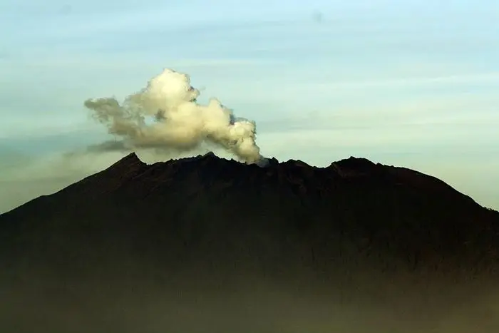
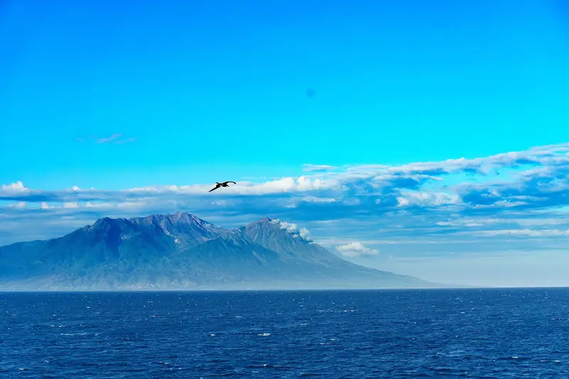
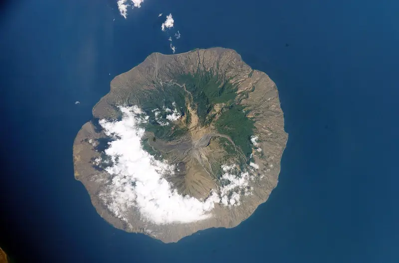
Anyone sailing from Bali to Komodo sees it go by: a round island 13 km across, made entirely of a volcano whose summit, at almost 2,000 m, often steams. This is Sangeang Api, "the fire of Sangeang". The island has had no permanent inhabitants since the eruptions of the 1980s; only farmers from Sumbawa come for the season.
For divers it is the site of the bubble reef: a coral reef where volcanic gas escapes from the seabed in columns of bubbles, among the corals and fish. For volcanologists it is a very active volcano, whose 2014 eruption sent ash 15 to 20 km high.
Climbing Sangeang Api is an expedition: no marked trail, no infrastructure, logistics by boat. That is why this guide is first and foremost a portrait of the volcano.
Sangeang Api at a glance
| Elevation | 1,949 m according to the PVMBG (Doro Api) |
|---|---|
| Type | Volcanic complex forming an island 13 km across |
| Cones | Doro Api (centre, active) and Doro Mantoi (eastern rim) |
| Eruptions | 22 recorded since 1512; the latest in 2022 |
| Location | Flores Sea, off the north-east coast of Sumbawa (Bima) |
| Alert level | II (Waspada) in November 2026 |
Can you go to Sangeang Api?
The box next to this article gives today's status. The volcano is at level II. The MAGMA report of 15 November 2026 forbids any activity within 3 km of the main crater, and in the east to south-east sector all the way to the shore, 6.5 km away. It records 16 deep volcanic earthquakes in 24 hours.
The west and north coasts of the island, outside these zones, can still be reached by boat. Diving around the island is offered by liveaboards, which decide according to the activity.
Getting there
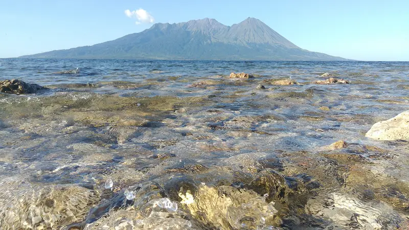
Sangeang Api is reached by sea from the north-east coast of Sumbawa:
- from Bima (airport linked to Lombok, Bali and Jakarta), by car to Wera, about 2 hours, then by fishing boat (about 1 hour);
- from Sape, the port for ferries to Labuan Bajo and Komodo;
- on a dive cruise between Bali, Lombok and Komodo, which sometimes stops at its reefs.
The climb
There is no maintained route. The rare expeditions leave from the south-west coast with farmers or fishermen from Wera as guides, cross the gardens and the forest, then climb the ash and scoria slopes of Doro Api. Allow two days, carry all your water, and get permission from the local authorities. At level II the crater is inside the exclusion zone.
We do not run Sangeang Api trips. For a wild, active volcano, see Raung.
Diving the bubble reef
South-east of the island, underwater volcanic gas vents send thousands of bubbles up between corals, sponges and anemones. The light through the bubbles, the very rich marine life and the black sand make it one of the most original dive sites in Indonesia. The site depends on volcanic activity: it may be closed when the alert level rises.
History
The island has long been farmed by people linked to the sultanate of Bima. Repeated eruptions gradually drove the inhabitants away. After the great eruption of 1985-1988, they were resettled on the coast of Sumbawa, in villages still called Sangeang Darat, "Sangeang on the mainland". Many come back to farm the island in the dry season, despite the risk.
The volcano
Sangeang Api is made of two large cones of trachybasalt and trachyandesite: Doro Api, in the centre, active, and Doro Mantoi, on the eastern rim of an older caldera that is largely buried. Secondary vents open south of Doro Mantoi and near the north coast. Its activity alternates explosions, ash plumes and lava flows running down to the sea.
The eruptions of Sangeang Api
The Smithsonian records 22 eruptions since 1512, most of them in the 20th century.
1512, 1715, 1821, 1860. The first known eruptions.
1911-1912, 1927. Explosions at Doro Api.
1953-1966. A very active phase, with a stronger eruption in 1953 (VEI 3).
1985-1988. A major eruption (VEI 3): lava flows and ash; the inhabitants leave the island.
1997-1999. A new explosive phase.
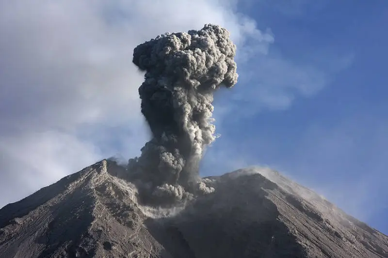
30 May 2014. An explosive eruption (VEI 3): an ash column 15 to 20 km high drifts south-east. Flights to Darwin, Australia, are cancelled and Bali airport is disrupted. Lava flows run down the east flank.
2017-2020, 2022. Explosions and moderate ash plumes.
Full timeline: 22 recorded eruptions
| Start | End | VEI | Location |
|---|---|---|---|
| 2022-02-17 | 2022-02-17 | 2 | |
| 2017-02-25 | 2020-06-10 | 2 | Summit crater, Doro Api cone |
| 2014-05-30 | 2015-11-05 | 3 | Summit crater and east flank |
| 2009-05-01 (uncertain) | 2009-06-03 | – | |
| 1997-07-02 | 1999-07-02 | 2 | |
| 1985-07-30 | 1988-02-16 | 3 | Doro Api |
| 1966-02-28 | 1966-11-16 | 2 | |
| 1964-01-29 | 1965-12-01 | 2 | Doro Api |
| 1958-07-02 | ? | 1 | |
| 1957-07-02 | ? | 1 | |
| 1956-12-16 | ? | 1 | |
| 1955-07-02 | ? | 1 | |
| 1954-11-04 | ? | 2 | |
| 1954-04-26 | ? | 2 | |
| 1953-03-19 | 1953-05-15 | 3 | Doro Api |
| 1927-07-02 | ? | 2 | |
| 1912-04-16 | ? | 2 | |
| 1911-02-13 | 1911-03-02 | 2 | Doro Api |
| 1860-09-11 | 1860-10-16 | 2 | |
| 1821-03-23 | ? | 2 | |
| 1715 | ? | 2 | |
| 1512 (uncertain) | ? | 3 |
Source: Smithsonian Institution, Global Volcanism Program. VEI = Volcanic Explosivity Index, from 0 (effusive) to 8 (supervolcano); each step means ten times more material.
How it is monitored
The PVMBG monitors Sangeang Api from an observatory on the coast of Sumbawa, at Sangeang Darat (Wera). Reports are published every day on MAGMA Indonesia.
Frequently asked questions
Can you climb Sangeang Api?
In theory yes, on a two-day expedition with guides from Wera and permission from the authorities. In practice, level II and the 3 km radius rule out access to the crater in November 2026.
Is the island inhabited?
Not permanently any more. Farmers from Sumbawa come to grow crops during the dry season.
Can you dive around the island?
Yes, on a liveaboard or with dive centres in Bima or Labuan Bajo, when volcanic activity allows.
Sources
- MAGMA Indonesia (PVMBG), Sangeang Api activity report of 15 November 2026
- Smithsonian Institution, Global Volcanism Program, Sangeang Api (264050)
Article updated on 16 November 2026