Why Raung
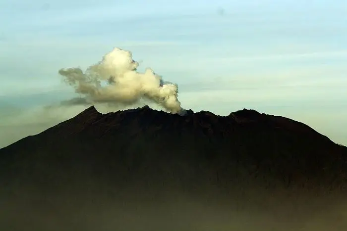
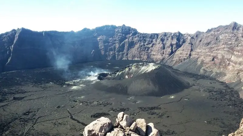
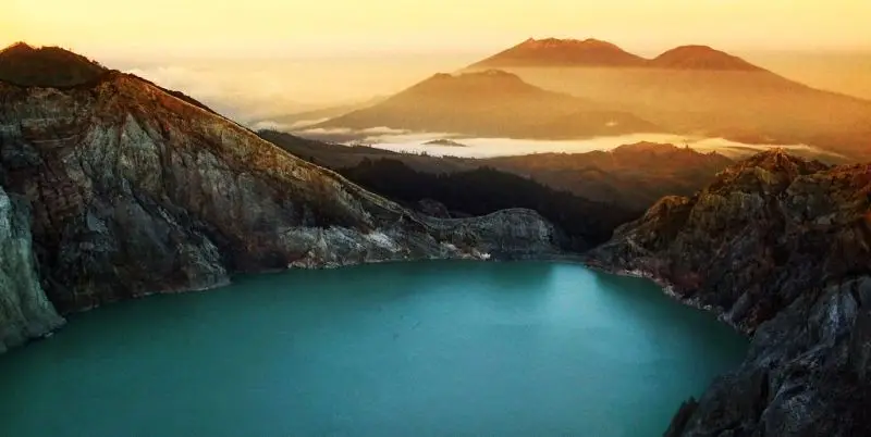
Raung is the volcano Java connoisseurs keep to themselves. No queues, no selfie stands, no jeeps: a very long climb through coffee bushes and then forest, camps where you are alone, and suddenly, at the edge of the void, a caldera two kilometres across and nearly 500 m deep, the largest in Java. At the bottom a small black cone steams, rumbles and, in some years, spits lava.
There are two Raungs. The north one, via Sumberwringin, is a big hike with no technical difficulty that leads to the caldera rim. The south one, via Kalibaru, leads to the true summit, Puncak Sejati, at the price of a ridge of rock and scoria where you rope up, with a drop on both sides. Indonesians rank it among the hardest climbs in the country. It is also one of the most beautiful.
If you have already done Bromo and Ijen and are looking for Java's "real wild volcano", this is it.
Raung at a glance
| Elevation | 3,332 m according to the PVMBG; 3,344 m is the figure traditionally given for Puncak Sejati |
|---|---|
| Type | Andesitic stratovolcano on the south-west rim of the Ijen caldera |
| Caldera | About 2 km across and about 500 m deep, with an active cone in the centre |
| Activity | Strombolian explosions and ash; 76 eruptions recorded, the latest in 2025 |
| Management | Registration posts at Sumberwringin (Bondowoso) and Wonorejo, Kalibaru (Banyuwangi) |
| North route | Sumberwringin → Pondok Angin → caldera rim: 2 days |
| South route | Kalibaru → Camp 7 → Puncak Sejati: 3 days, roped sections |
| Difficulty | North route: long and sustained. South route: very committing |
Is Raung open?
The box next to this article gives today's status, with its source and date.
Raung is at level II (Waspada). The MAGMA report of 15 November 2026 advises not approaching within 3 km of the crater centre and not going down into the caldera. But the caldera is two kilometres wide: its rim lies about a kilometre from the active cone, and therefore inside the exclusion zone.
The routes are still managed locally and many Indonesian hikers keep climbing: regional media reported heavy traffic on the Sumberwringin route in July 2026. Our position is simple: as long as level II and its 3 km radius are in force, we stop our groups before the rim, at a viewpoint over the caldera outside the exclusion zone. When the PVMBG reduces the radius, we go back to the ridge.
When to go to Raung
- May to October, in the dry season. Essential for the south route: on scoria ridges, rain and fog turn a committing climb into a dangerous one.
- July–September: the most reliable skies, but a fire risk late in the season. In 2026 several East Java volcanoes were closed because of forest fires.
- November to April: avoid. The south route is often closed by local managers during the rains.
Getting to Raung
The two routes do not meet: you go up and down on the same side.
The north route, via Bondowoso and Sumberwringin
Sumberwringin (about 730 m) is a coffee-growing village south-east of Bondowoso, 3 hours by road from Banyuwangi, 2 h 30 from Probolinggo, 4 to 5 h from Malang. The registration post is run by villagers. You hire motorbike taxis there to ride up through the plantations to Pondok Motor (1,182 m), where the walk really begins. It is simplest to sleep in Bondowoso the night before.
The south route, via Kalibaru
Kalibaru is a small town on the Malang – Banyuwangi railway, among coffee and cocoa plantations. From there a motorbike takes 20 minutes to Wonorejo (570 m), where the registration post is, then another 30 minutes of muddy track to Camp 1 (900 m). A transfer from Banyuwangi costs about 750,000 IDR (≈ 38 €) per vehicle. A third route, via Glenmore, longer and harder, is rarely used.
The north route, stage by stage
| Stage | Elevation | Time |
|---|---|---|
| Sumberwringin → Pondok Motor (motorbike) | 730 → 1,182 m | 40 min |
| Pondok Motor → Pondok Sumur | → about 1,900 m | 3 h |
| Pondok Sumur → Pondok Angin (camp) | → 2,806 m | 3 h 30 |
| Pondok Angin → caldera rim | → 3,100-3,300 m | 40 min to 1 h 30 |
| Back to Pondok Motor | 5 h |
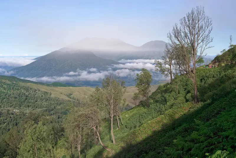
The trail first crosses the coffee bushes, then pine forest and increasingly sparse mountain vegetation. On the right, Argopuro rises from the clouds; on the left, the pretty cone of Gunung Suket. There are several camping spots along the way, small and sloping: with more than five tents it is cramped. There is no water source: everything is carried up from below.
The next day you leave around 4:30 am. In a few dozen minutes to an hour and a half depending on the point you aim for, you leave the vegetation and the caldera appears at sunrise. It is one of the great moments of Javanese volcanism. Then you go back down to Pondok Motor and Sumberwringin the same day.
Map and GPX track
- Sumberwringin → Pos 7 → bord de la caldeiraDistance 11 km · Elevation gain 1,936 m · Start 1,164 m → High point 3,141 mDownload the GPX track ↓
Indicative route from OpenStreetMap; elevations from Copernicus. Check on the ground and follow your guide. © OpenStreetMap, OpenTopoMap (CC-BY-SA), Open-Meteo.
The south route to Puncak Sejati, stage by stage
Day 1: Kalibaru → Camp 7
From Camp 1 (900 m), the forest climbs steadily: Camp 2 (1,450 m) in under two hours, then Camps 3, 4, 5 and 6 (2,220 m, near a seismic station) every 30 to 45 minutes. Camp 7 (2,555 m) is reached in 6 to 7 hours. There is room for about ten tents and views of Argopuro and Semeru. No water: everything is carried.
Day 2: the summit
Start at 4 am. Camp 8 (2,870 m) in an hour, Camp 9 (3,070 m) in another hour, then the end of the vegetation at around 3,115 m. Five minutes further on, Puncak Bendera (about 3,140 m), the "flag summit", gives the first view of the caldera and of what remains to be done. This is where helmets and harnesses go on, and where some decide to stop.
From Puncak Bendera it takes about three hours to reach Puncak Sejati, on one of the hardest trails in Indonesia:
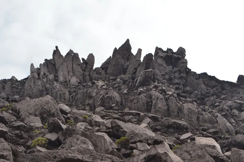
- a first very narrow ridge, with a short rock step climbed on a rope: the key passage;
- Puncak 17 (about 3,173 m), a pyramid-shaped summit, from which you abseil about twenty metres down the other side;
- a second knife-edge ridge, with two short roped sections;
- a vast slope of rocks and gullies, then the vertical slabs of Puncak Tusuk Gigi ("toothpick peak", about 3,315 m);
- a few more minutes to Puncak Sejati, the true summit.
From there the view takes in the caldera, Glenmore Peak to the east, Ijen and Ijen's Merapi, Baluran park, Argopuro and Semeru. The return to Puncak Bendera takes 2 h 30, then under two hours to Camp 7, where you spend a second night.
Day 3: back to Kalibaru
Six hours of descent to Camp 1, then the motorbike to Kalibaru.
Do I need a guide?
For the north route: a local guide is strongly recommended. There are junctions in the plantations, the water has to be organised, and the ground at the top is unstable. For the south route: it is essential, with equipment (helmets, harnesses, ropes) and someone who knows every passage. In practice the Kalibaru managers require local guides for Puncak Sejati.
How much does climbing Raung cost?
The entrance fee, collected by the local managers, is modest: about 75,000 IDR (≈ 4 €) per person for a foreigner. Most of the budget goes on guides, porters (essential: all the water is carried), transport to the trailheads and, in the south, climbing gear.
With Terre des Volcans, the north route starts at 2,700,000 IDR (≈ 135 €) per person and the south route at 3,550,000 IDR (≈ 178 €), depending on group size, with guide, porters, camp, meals and, in the south, helmets and ropes. Raung also combines with Ijen.
Our Raung trips
Raung from the north in 2 days
Java's biggest caldera, no rope needed: a long climb, one camp, a dizzying crater rim.
- 2 days / 1 nights
- ●●●●● Moderate
- Start : Bondowoso → Bondowoso / Banyuwangi
- Departs on the date you choose · max. 10 people
from 2,700,000 IDR ≈ 135 € per person
Access to be confirmed: Raung. See volcano status
Itinerary
- Day 1 — Bondowoso → Pondok Motor → Pondok Angin camp
1.5 hours by road via Sumberwringin to Pondok Motor (1,182 m). 3 hours through coffee plantations and forest, lunch, then 3.5 more hours to camp (2,806 m). - Day 2 — Raung caldera rim, then down
Leave at 4:30, 40 minutes to the rim: a caldera 2 km wide and 500 m deep at sunrise. Breakfast at camp, descent, return to Bondowoso or Banyuwangi.
Departures
- Bondowoso — 07:00
| Group size | Price per person | Approx. |
|---|---|---|
| 2 people | 3,700,000 IDR | ≈ 185 € |
| 3 people | 3,200,000 IDR | ≈ 160 € |
| 4 people | 3,000,000 IDR | ≈ 150 € |
| 5 people | 2,800,000 IDR | ≈ 140 € |
| 6 people or more | 2,700,000 IDR | ≈ 135 € |
✓ Park entrance fees included.
Included
- English-speaking Terre des Volcans guide throughout the trek
- Local guide
- Porters for camping gear, water and food
- Camping gear: two-person tent, sleeping bag, mattress
- All meals during the trek
- Water, snacks and fruit
- Park entrance fees
Not included
- Nights before and after the trek
- Transfer to the starting point (optional extra)
- Drinks
- Tips
- Travel and evacuation insurance
Options
- Transfer Banyuwangi → trailhead, one way — 750,000 IDR (≈ 38 €) per vehicle (max. 5 people)
- French-speaking guide (subject to availability) — on request
Raung from the south, Puncak Sejati, 3 days
The true summit of Raung, roped up. One of the hardest treks in Indonesia: we advise against it, unless it is exactly what you are after.
- 3 days / 2 nights
- ●●●●● Very demanding
- Start : Kalibaru
- Departs on the date you choose · max. 8 people
from 3,550,000 IDR ≈ 178 € per person
Access to be confirmed: Raung. See volcano status
Itinerary
- Day 1 — Kalibaru → Camp 7
A long forest climb from Kalibaru. There is no water on the route: everything is carried. Night in tents at Camp 7. - Day 2 — Puncak Sejati (3,344 m), roped up
Leave at 4:00. Exposed ridges, roped sections, Puncak Bendera, Puncak Tusuk Gigi, then the true summit. The most technical day we offer. Back to camp. - Day 3 — Down to Kalibaru
Breakfast at camp, descent through the forest, ends in Kalibaru (station on the Malang – Banyuwangi line).
Departures
- Kalibaru — 07:00
| Group size | Price per person | Approx. |
|---|---|---|
| 2 people | 5,600,000 IDR | ≈ 280 € |
| 3 people | 4,650,000 IDR | ≈ 233 € |
| 4 people | 4,200,000 IDR | ≈ 210 € |
| 5 people | 3,900,000 IDR | ≈ 195 € |
| 6 people | 3,750,000 IDR | ≈ 188 € |
| 7 people or more | 3,550,000 IDR | ≈ 178 € |
✓ Park entrance fees included.
Included
- English-speaking Terre des Volcans guide throughout the trek
- Local guide
- Porters for camping gear, water and food
- Camping gear: two-person tent, sleeping bag, mattress
- Helmet, harness and ropes
- All meals during the trek
- Water, snacks and fruit
- Park entrance fees
Not included
- Nights before and after the trek
- Transfer to the starting point (optional extra)
- Drinks
- Tips
- Travel and evacuation insurance
Options
- Transfer Banyuwangi → trailhead, one way — 750,000 IDR (≈ 38 €) per vehicle (max. 5 people)
- French-speaking guide (subject to availability) — on request
Combine it in a tour
What to bring
- Hiking boots with stiff soles: the scoria at the top cuts
- Warm clothes: it almost freezes at camp and at the summit
- Gloves for the rocky passages of the south route
- Head torch, sunglasses, sunscreen
- At least 4 to 5 litres of water per person per day, carried by the team
- Real confidence in your ability to walk an exposed ridge, for the south route
Mistakes to avoid
- Confusing the two routes. The north leads to the caldera rim, the south to the true summit. You cannot cross from one to the other.
- Setting off without a water supply. There is no spring on the mountain.
- Attempting Puncak Sejati without a rope or a guide. Hikers have died there.
- Improvising. Give at least a week's notice to gather guides, porters and gear.
- Going down into the caldera. It is forbidden, and the walls are unstable.
The history of climbing Raung
Raung was long a remote mountain in the heart of the forests of Blambangan, the last Hindu kingdom of East Java. Colonial-era naturalists approached it in the 19th century from the north, through the Bondowoso plantations, and described its huge crater. Franz Wilhelm Junghuhn depicted it in his views of East Java's volcanoes.
For a long time the caldera rim from the north was enough for most visitors. The south ridge, with Puncak Bendera, Puncak 17, Tusuk Gigi and Puncak Sejati, has only been climbed regularly since the 1990s and 2000s, driven by Indonesian student mountaineering clubs and Kalibaru guides who equipped the tricky passages. Raung then became the goal of Indonesian hikers who had "done everything", and joined the list of Java's seven most coveted volcanic summits.
As on other volcanoes, the influx of hikers led to accidents, often on the exposed ridges, and to compulsory registration, local guides and limits tied to the alert level.
The volcano: how Raung works
Raung is a large andesitic stratovolcano built on the south-west rim of the Ijen caldera, an old collapsed volcano 20 km across. It belongs to a north-east to south-west line of volcanic centres, with Gunung Suket to the north-east and Gunung Gadung to the west.
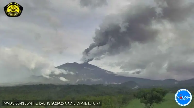
Its bare summit is truncated by a sheer-walled caldera about 2 km across, at the bottom of which a pyroclastic cone is growing. This cone is the active part: it produces Strombolian explosions (sprays of incandescent lava), ash plumes and sometimes small lava flows that fill the caldera floor.
To the west, Gunung Gadung collapsed in prehistoric times. The debris avalanche that came out of it travelled 79 km, almost to the Indian Ocean. It is one of the longest known in Indonesia. The hills scattered across the Jember plain are its remains.
The eruptions of Raung
The Smithsonian records 76 eruptions of Raung, which makes it one of Java's most active volcanoes.
1586-1638. A series of large eruptions, including that of 1593, one of the strongest in the volcano's history (VEI 5), and that of 1638, accompanied by deadly mudflows.
1817. A major eruption (VEI 4) in January, at the same time as neighbouring Ijen.
19th and 20th centuries. Moderate eruptions every two to ten years, sometimes with lava flows in the caldera (1913, 1927-1928) and stronger explosions in 1953, 1956 and 1982.
June to August 2015. The central cone erupts in Strombolian style, lava fills the caldera floor and ash plumes drift east. The airports of Bali, Lombok, Banyuwangi and Jember are closed several times: tens of thousands of travellers are stranded.
2020-2021. A new phase of ash eruptions, which closes the Kalibaru route.
2022, December 2024, March 2025. Shorter ash explosions.
2026. Level II, deep volcanic earthquakes and isolated gas explosions: the volcano remains under watch.
Full timeline: 76 recorded eruptions
| Start | End | VEI | Location |
|---|---|---|---|
| 2025-03-13 | 2025-07-11 | 2 | |
| 2024-12-15 | 2024-12-24 | 2 | |
| 2022-05-14 | 2022-09-27 | 2 | |
| 2021-01-21 | 2021-04-14 | 2 | |
| 2020-07-16 | 2020-10-03 | 1 | |
| 2014-11-23 | 2015-08-30 | 2 | Summit crater |
| 2014-01-04 (uncertain) | 2014-01-04 | 1 | |
| 2013-06-29 | 2013-07-31 | 1 | Summit crater |
| 2012-10-16 | 2013-01-06 | 1 | Summit crater |
| 2008-06-12 | 2008-06-17 | 2 | |
| 2007-07-26 | 2007-08-26 | 2 | |
| 2005-07-23 (uncertain) | 2005-08-15 | 2 | |
| 2004-04-15 (uncertain) | 2004-10-08 | 2 | |
| 2002-06-16 | 2002-08-25 | 2 | |
| 2000-07-09 | 2000-07-09 | 2 | |
| 1999-07-30 | ? | 2 | |
| 1997-04-16 | ? | 2 | |
| 1995-08-15 (uncertain) | ? | 2 | |
| 1995-03-16 | 1995-03-16 | 1 | |
| 1994-07-14 | 1994-07-14 | 1 | |
| 1993-04-01 | ? | 1 | |
| 1991-09-10 | 1991-11-12 | 2 | |
| 1990-01-16 | 1990-12-16 | 2 | |
| 1987-05-16 | 1989-07-28 | 1 | |
| 1985-08-23 | 1986-02-28 | 2 | |
| 1982-07-18 | 1982-07-20 | 3 | |
| 1978-01-16 | 1979-12-16 | 1 | |
| 1977-06-09 | 1977-06-30 | 2 | |
| 1976-06-07 | 1976-11-21 | 2 | |
| 1975-03-16 | 1975-05-16 | 1 | |
| 1974-06-15 | 1974-07-17 | 2 | |
| 1973-05-16 | 1973-10-16 | 1 | |
| 1971-09-14 | 1971-09-14 | 1 | |
| 1956-02-13 | 1956-03-25 | 3 | |
| 1955-01-18 | 1955-01-18 | 2 | |
| 1953-01-31 | 1953-04-15 | 3 | |
| 1944-06-30 | 1945-04-19 | 2 | |
| 1943-03-17 | 1943-06-18 | 2 | |
| 1941-12-13 | ? | 2 | |
| 1940-07-02 | ? | 2 | |
| 1938-08-13 | 1939-01-10 | 2 | |
| 1937-10-27 | 1937-11-27 | 2 | |
| 1936-08-22 | 1936-12-11 | 2 | |
| 1933-11-21 | 1933-12-06 | 2 | |
| 1929-04-27 | ? | 2 | |
| 1928-11-16 | ? | 2 | |
| 1927-08-02 | 1928-03-16 | 2 | Central cone and NW crater wall |
| 1924-08-20 (uncertain) | ? | 2 | |
| 1924-02-16 | ? | 2 | |
| 1921-02-14 | 1921-04-16 | 2 | 1913 cone |
| 1917-02-22 | ? | 2 | |
| 1916-11-16 | 1916-12-16 | 2 | |
| 1915-05-16 | ? | 2 | |
| 1913-05-10 | 1913-12-16 | 2 | |
| 1903-11-28 | 1904-01-16 | 2 | |
| 1902-02-16 | 1902-02-27 | 2 | |
| 1897-04-16 | ? | 2 | |
| 1896-08-16 | ? | 2 | |
| 1890-07-16 | 1890-09-15 | 2 | |
| 1885-06-21 | 1885-06-22 | 2 | |
| 1881-07-02 | ? | – | |
| 1864-07-02 | 1864-12-16 | 2 | |
| 1860-09-16 | ? | 2 | |
| 1859-12-14 | ? | 2 | |
| 1849-12-01 | ? | – | |
| 1838-07-02 | ? | 2 | |
| 1817-01-16 | 1817-02-10 | 4 | |
| 1815-12-31 | ? | 2 | |
| 1812-07-02 | 1814-07-02 | 2 | |
| 1804-07-02 | ? | 2 | |
| 1793 | ? | 2 | |
| 1730 | ? | 3 | |
| 1638 | ? | 4 | |
| 1597-01-17 | 1597-02-02 | 3 | |
| 1593 | ? | 5 | |
| 1586 (uncertain) | ? | 3 |
Source: Smithsonian Institution, Global Volcanism Program. VEI = Volcanic Explosivity Index, from 0 (effusive) to 8 (supervolcano); each step means ten times more material.
How Raung is monitored
The PVMBG observatory at Sumberarum (Songgon, Banyuwangi) monitors Raung continuously. The daily reports on MAGMA Indonesia are the reference: the one of 15 November 2026 records one gas explosion and four deep volcanic earthquakes.
Around Raung
- Kawah Ijen, an hour's drive away: see our guide. Our Kawah Ijen – Raung tour links the two.
- The Kalibaru plantations, coffee, cocoa and cloves, with a few colonial hotels.
- The Ijen plateau and its coffee-growing villages.
- Argopuro, Java's longest trek, to the west: see the guide.
Frequently asked questions
North route or south route?
The north route leads to the caldera rim in two days of sustained walking, with no technical difficulty. The south route leads to the highest point, Puncak Sejati, in three days, with exposed ridges and roped sections. The view of the caldera is comparable. If in doubt, take the north route.
Is Raung open in 2026?
The volcano is at level II, with a 3 km exclusion zone around the crater. The routes are managed locally and still used, but the caldera rim lies inside that zone. We stop our groups before it as long as the recommendation is in force. Today's status is in the box on this page.
Do you need to be a climber for Puncak Sejati?
You do not need to be a climber, but you must not suffer from vertigo, must accept walking narrow ridges above a drop and must follow the roping instructions. The guides provide the equipment.
Is climbing Raung dangerous?
The south route objectively is: hikers have fallen there. The north route carries the risks of a long high-altitude hike. Both are exposed to the volcano itself when activity increases.
How many days does it take?
Two days for the north route, three for the south route. Add a night in Bondowoso or Kalibaru the night before.
How much does climbing Raung cost?
The local entrance fee is about 75,000 IDR (≈ 4 €) per person. With Terre des Volcans, the north route starts at 2,700,000 IDR (≈ 135 €) and the south route at 3,550,000 IDR (≈ 178 €) per person, depending on group size.
Is there water on Raung?
No, no spring at all. Each person needs four to five litres a day, carried from below. That is the main reason to have porters.
Can you combine Raung and Ijen?
Yes: the two volcanoes share the same caldera and are an hour's drive apart. Our Kawah Ijen – Raung tour links them in three days from Banyuwangi.
Can you go down into the caldera?
No. The PVMBG forbids it, and the nearly 500 m vertical walls are unstable.
Sources
- MAGMA Indonesia (PVMBG), Raung activity report of 15 November 2026
- Smithsonian Institution, Global Volcanism Program, Raung (263340)
- RRI Jember (traffic on the Sumberwringin route, July 2026), Times Indonesia (classic Bondowoso route), Detik (Wonorejo route, December 2025)
- Our own climbs of Raung, from the north and the south
Article updated on 16 November 2026