Why Semeru
There are volcanoes you visit and volcanoes you earn. Semeru belongs to the second kind. No road to the crater, no cable car, no hat sellers at the top: two days' walk, a night in a tent at the foot of a grey pyramid, and an alarm at midnight to tackle a slope of sand where every step forward costs you two back.
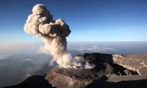
In return, Semeru offers what almost no other volcano in the world does: the chance to see a volcano in permanent eruption from a place where you can camp. Since 1967 the Jonggring Saloko crater has let off an explosion every fifteen to thirty minutes. You hear it rumble from the lake at Ranu Kumbolo, you see the plume rise above Kalimati, and when the summit is open you watch it explode a few hundred metres away at sunrise, with the whole island of Java at its feet.
The trail itself is worth the trip. A cloud forest draped in lichen, a high-altitude lake sacred to the Tengger, a savannah that turns purple then gold with the seasons, starry nights at 2,700 metres. Even when the summit is closed, which is often, the trek to Ranu Kumbolo remains one of the finest hikes in Indonesia.
And then there is a feeling you only understand once you have lived it: sensing a mountain alive, trembling, breathing. Many of our travellers come back from Semeru saying the same thing: "now I see why people get hooked".
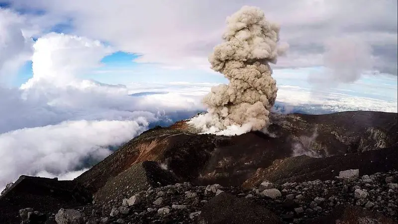
Semeru at a glance
| Elevation | 3,676 m (Mahameru), the highest point in Java, Indonesia's 3rd-highest volcano after Kerinci and Rinjani |
|---|---|
| Type | Andesitic stratovolcano, at the southern end of the Tengger-Semeru massif |
| Active crater | Jonggring Saloko, a few hundred metres south-east of the summit |
| Activity | Explosions every 15 to 30 minutes since 1967; pyroclastic flows and lahars on the south-east flank |
| Manager | Balai Besar Taman Nasional Bromo Tengger Semeru (TNBTS) |
| Trailhead | Ranupani, 2,100 m, 1 h 30 by jeep from Tumpang |
| Duration | 2 days (minimum) to 3 days return |
| Distance | About 17 km from Ranupani to the summit, the same back |
| Elevation gain | About 1,600 m from Ranupani, nearly 1,000 m of it in sand on the final climb |
| Difficulty | Demanding to Kalimati, very hard beyond |
Is Semeru open today?
It is the first question to ask, and the answer changes often. The box next to this article gives today's status, with its source and date. Here is the context for reading it.
Two separate decisions apply to Semeru. The alert level is set by the PVMBG, Indonesia's volcanological survey, on a scale from 1 (normal) to 4 (danger). The opening of the trail is decided by the national park (TNBTS). Semeru can therefore be open as far as the lake while the summit stays off limits, or be closed completely for a reason that has nothing to do with the volcano, such as a forest fire.
Recent years have been eventful:
- December 2021: dome collapse and pyroclastic flows in the Besuk Kobokan valley, Semeru's worst disaster in decades. The trail closes.
- December 2022: raised to level IV (Awas), the maximum, after new pyroclastic flows.
- 19 November 2025: another major eruption, back to level IV. More than 170 hikers camping at Ranu Kumbolo came down safe and sound. The trail closes.
- 24 April 2026: reopening, but only as far as Ranu Kumbolo lake, with a quota of 200 hikers a day.
- 27 August 2026: full closure because of a forest fire near Ranu Kembang. About 170 hikers are evacuated. On 31 August the Ministry of Forestry suspends hiking in nine national parks, Semeru's among them.
- November 2026: the volcano is at level III (Siaga). The MAGMA report of 16 November counts 23 explosion earthquakes in six hours. The PVMBG bans all activity within 5 km of the crater and up to 13 km in the south-east sector.
If Semeru is closed on your dates, there are strong alternatives nearby: Bromo just to the north, Arjuno-Welirang for a real two-day trek above 3,000 m, or Raung for the largest caldera in Java.
When to climb Semeru
The dry season, from May to October, is the only one we really recommend. The sky is clear in the morning, the trail is dry, and the view from the summit reaches from the Indian Ocean to the Java Sea.
- April–May: end of the rains, the Oro-Oro Ombo savannah is green and in flower. Our favourite time.
- June–August: clearest skies, but freezing nights. At Ranu Kumbolo, frost (embun upas, "poisonous dew" in Javanese) whitens the grass on some July and August nights, with temperatures below zero.
- September–October: golden savannah, dust and fire risk. The fires of 2023 and 2026 both happened at the end of the dry season.
- November to March: rainy season. The park usually closes the trail between January and March to let the ecosystem recover.
Also avoid long weekends and Indonesian school holidays (late June–July, late December): the daily quota fills up fast.
Getting to Semeru
Every climb starts from the village of Ranupani (2,100 m), the highest in East Java, in the heart of the national park. You almost always reach it via Tumpang, a small town 20 km east of Malang, where our base is.
From Malang and Tumpang
Malang has a railway station (direct trains from Surabaya, Yogyakarta and Jakarta) and a small airport. From the station or airport, a taxi to Tumpang costs about 100,000 IDR (≈ 5 €) per vehicle. Jeeps are not allowed to pick up at Malang station: you must get to Tumpang first.
From Tumpang, the road winds up through Gubugklakah, Ngadas and the Jemplang pass to Ranupani: 1 h 30 by jeep, about 650,000 IDR (≈ 33 €) per five-seat jeep, one way. From a hotel in Malang, allow rather 750,000 IDR (≈ 38 €). In high season, shared jeeps go as far as Jemplang for about 75,000 IDR (≈ 4 €) per person, but several kilometres on foot remain after that, and you have to wait for the jeep to fill. A motorbike taxi (ojek) costs about 200,000 IDR (≈ 10 €).
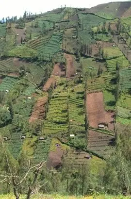
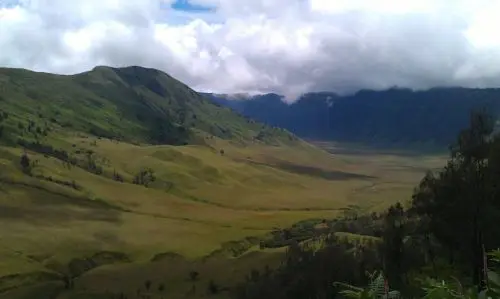
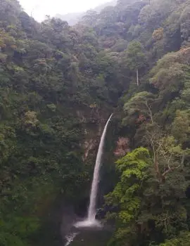
The road is worth doing by day: potato and cabbage fields clinging to dizzying slopes at Ngadas, a first view of the Tengger caldera at Jemplang, and the Coban Pelangi waterfall on the way (15,000 IDR (≈ 1 €) entry).
From Surabaya
Juanda international airport is 2 h 30 to 3 h from Tumpang. A private taxi costs about 600,000 IDR (≈ 30 €). Cheaper: the DAMRI bus to Bungurasih bus station (25,000 IDR (≈ 1 €)), then a bus to Arjosari (Malang), then a taxi to Tumpang. Allow half a day.
From Bromo
The two volcanoes are neighbours. From Cemoro Lawang, a jeep crosses the sea of sand and the Tengger savannah to Ranupani in about an hour, for 550,000 IDR (≈ 28 €). It is the most logical combination, and the one in our Semeru – Bromo tour.
From Lumajang
From the east, a road climbs from Lumajang via Senduro and Burno to Ranupani (about 2 h). It is handier if you are coming from Banyuwangi or Bali.
From Yogyakarta, Bali or Jakarta
- Yogyakarta: direct trains to Malang (7 to 8 hours), including night trains.
- Bali: fly to Surabaya or Malang, or ferry to Banyuwangi then train to Malang (about 7 hours).
- Jakarta: direct flights to Malang (1 h 30) or Surabaya, or night train.
The climb, stage by stage
| Stage | Elevation | Distance | Time |
|---|---|---|---|
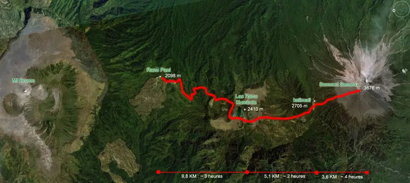
| Ranupani → Ranu Kumbolo | 2,100 → 2,400 m | 10.5 km | 3 to 4 h |
| Ranu Kumbolo → Kalimati | 2,400 → 2,700 m | 5 km | 2 to 3 h |
| Kalimati → Arcopodo | 2,700 → 2,900 m | 1.2 km | 1 h |
| Arcopodo → Mahameru (summit) | 2,900 → 3,676 m | 1.5 km | 3 to 4 h |
| Summit → Ranupani | 3,676 → 2,100 m | 18 km | 6 to 8 h |
Times are for a fit hiker. The sections beyond Ranu Kumbolo or Kalimati are only accessible when the park opens them.
Ranupani, the starting village
Ranupani is a Tengger village perched at 2,100 m on the shore of a small lake of the same name, next to its neighbour Ranu Regulo. This is where you show your booking and medical certificate at the park post, attend the compulsory briefing and meet the porters. The small village clinic issues the medical certificate for about 25,000 IDR (≈ 1 €).
To Ranu Kumbolo lake
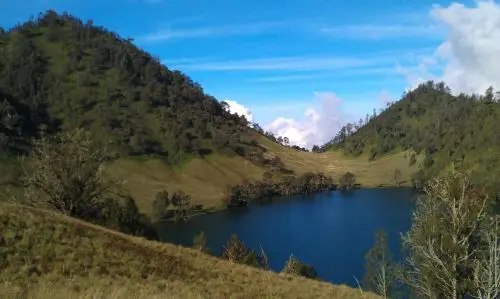
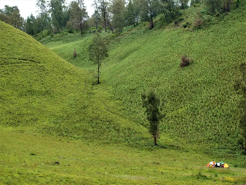
For 10 km the trail crosses a damp, moss-covered cloud forest, via Landengan Dowo and Watu Rejeng. The gradient is gentle and steady, with four shelters (pos) on the way. Then the forest suddenly opens onto Ranu Kumbolo, a 15-hectare lake at 2,400 m, ringed by grassy hills. Early in the morning, mist rises off the water as the sun comes up between two ridges: it is the best-known image of Semeru, and it does not lie.
The lake is sacred to the Tengger. You do not wash anything in it and you do not swim.
Tanjakan Cinta and the Oro-Oro Ombo savannah
Behind the lake is a steep hill: Tanjakan Cinta, the "slope of love". Legend says that whoever climbs it without looking back, thinking of their beloved, will have their wish granted. Everyone looks back: the view of the lake is too beautiful.
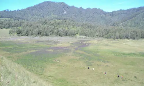
On the other side lies Oro-Oro Ombo, a high savannah ringed by hills. In spring it is covered in purple flowers. It is spectacular, but it is an invasive verbena that the park is trying to eradicate. In the dry season the savannah turns gold and silver.
Kalimati, the camp at the foot of the cone
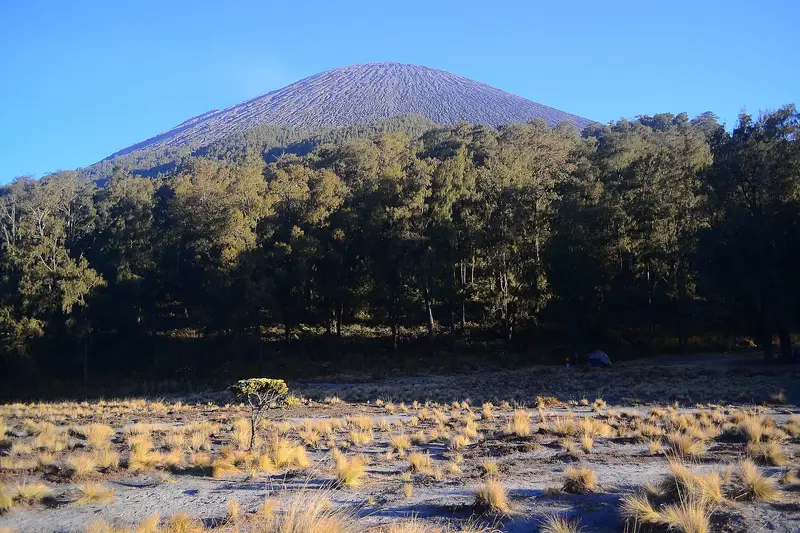
After the Cemoro Kandang forest and the Jambangan clearing, from where the whole cone of Semeru comes into view, you reach Kalimati (2,700 m), a wide sandy clearing at the foot of the volcano. It is the last camp. Water comes from the Sumbermani spring, 30 minutes' walk below. It gets cold as soon as the sun sets, often around 0 °C, and the crater plume passes right over the tents.
The summit push
When the summit is open, the alarm goes off around midnight. You first climb for an hour through forest to Arcopodo (2,900 m), then pass the tree line at Kelik. Then begins the part that made Semeru's reputation: nearly 800 m of ascent through a mix of ash, sand and gravel, at a gradient close to 40 degrees. For every three steps forward you slide back two. Add cold, wind and dust. The fastest take three hours, many take four.
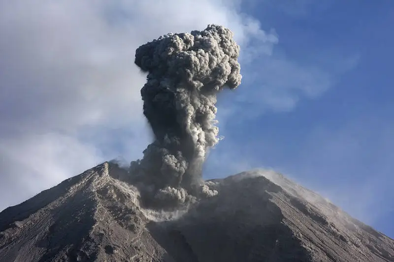
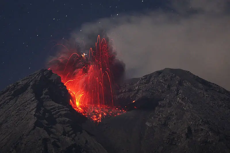
At the top, on the Mahameru plateau, the reward is immediate. On a clear day you can see the Indian Ocean to the south, the Java Sea to the north, the Tengger massif and Bromo, Arjuno, Welirang, Kawi, Argopuro, Raung and, in the distance, the volcanoes of Bali. And roughly every twenty minutes Jonggring Saloko explodes right next to you, with a rumble you feel in your chest. Before dawn you can sometimes see lava glowing.
The safety rules at the summit are not up for debate: leave the summit before 10 am (the wind then blows the gas onto the plateau), never approach the crater rim, never go down into the ravines.
The descent
The sand that made you suffer so much on the way up becomes an ally: you go down it in long strides, almost running, in an hour. Take care where the sand ends: that is where hikers have got lost by taking the wrong ravine. Then you still have to walk the whole way back to Ranupani, about 18 km in the day. It is the part nobody talks about, and the one that wears out your knees the most.
Map and GPX track
- Ranupani → Ranu Kumbolo → Kalimati → MahameruDistance 15.5 km · Elevation gain 1,897 m · Start 2,087 m → High point 3,665 mDownload the GPX track ↓
Indicative route from OpenStreetMap; elevations from Copernicus. Check on the ground and follow your guide. © OpenStreetMap, OpenTopoMap (CC-BY-SA), Open-Meteo.
Booking, quotas and rules
Since 2014, access to Semeru has been tightly controlled. What applies in 2026:
- Online booking is compulsory on the park's official website (bromotenggersemeru.id), between 30 and 2 days before departure. Names can no longer be changed after booking.
- Quota: 200 hikers a day at the April 2026 reopening.
- Medical certificate less than 24 to 48 hours old, from a clinic in Malang, Tumpang or Ranupani.
- Passport (copy) and compulsory briefing in Ranupani.
- Limited stay: two to three nights maximum in the park.
- Forbidden: lighting fires, going beyond the set limit (Ranu Kumbolo in 2026), opening new trails, flying a drone, leaving rubbish. Rubbish is counted on the way in and the way out.
- Age: the park long set a minimum age of 10. Check before bringing a child.
How much does climbing Semeru cost?
Entrance fees
For a foreign visitor, the park entrance fee is 220,000 IDR (≈ 11 €) per day per person, payable for each day spent in the park (two or three days depending on the route). Indonesians pay about ten times less.
If you organise it yourself
Local price guide, to be checked on the spot:
| Item | Indicative price |
|---|---|
| Jeep Tumpang → Ranupani (one way, 5 seats) | 650,000 IDR (≈ 33 €) |
| Medical certificate in Ranupani | 25,000 IDR (≈ 1 €) |
| Tent + sleeping bag + mat rental, per day | 50,000 IDR (≈ 3 €) |
| Porter, per day | 300,000 IDR (≈ 15 €) |
| English-speaking guide, per day | 500,000 IDR (≈ 25 €) |
For two people, between entrance fees, the return jeep, a guide, a porter, the gear and the food, you quickly exceed the price of an organised trek.
With Terre des Volcans
Our treks leave from Tumpang and include the guide, porters, camping gear, meals, jeep and medical certificate, from 2,300,000 IDR (≈ 115 €) per person depending on group size. Details, prices by group size and options are just below.
With or without a guide?
For an Indonesian used to the mountains, Semeru can be done without a guide: the trail to Kalimati is obvious. For a foreign traveller we advise against it, and not just as a sales pitch:
- the online booking, certificate, briefing and rules change often and are in Indonesian;
- Semeru has already swallowed hikers: some got lost coming down the cone, and a few were never found;
- a porter saves you carrying 15 kilos of tent and water up to 2,700 m, and leaves you energy for what comes next;
- a local guide knows how to read the volcano, the wind and the weather, and knows when to turn back.
Most porters come from the villages of Ranupani and Ngadas and make their living from it. Paying them properly is part of the trip.
Our Semeru treks
Semeru in 2 days
The roof of Java, the direct way: one night in a tent, and as high as the park allows on the day.
- 2 days / 1 nights
- ●●●●● Hard
- Start : Tumpang
- Can depart any day · max. 12 people
from 2,300,000 IDR ≈ 115 € per person
Currently closed: Semeru. You can still ask for a quote for a later date, no commitment. See volcano status
Itinerary
- Day 1 — Tumpang → Ranupani → Ranu Kumbolo → Kalimati
Medical certificate, then 1.5 hours by jeep to Ranupani (2,100 m). A 3-hour walk to Lake Ranu Kumbolo, lunch, then 2 hours to Kalimati camp (2,700 m) if the park allows it; otherwise we camp by the lake. - Day 2 — Summit (if allowed), then back to Tumpang
Wake-up at 00:30. If the summit is open: 3 to 4 hours in volcanic sand, almost 1,000 m of ascent, sunrise above Java. Down via the lake, jeep to Tumpang.
Departures
- Tumpang — 06:30
| Group size | Price per person | Approx. |
|---|---|---|
| 1 person (solo) | 2,800,000 IDR | ≈ 140 € |
| 2 people | 3,000,000 IDR | ≈ 150 € |
| 3 people | 2,600,000 IDR | ≈ 130 € |
| 4 to 6 people | 2,400,000 IDR | ≈ 120 € |
| 7 people or more | 2,300,000 IDR | ≈ 115 € |
Entrance fees to add: Semeru : 220,000 IDR (≈ 11 €) per day, per person × 2.
Included
- English-speaking Terre des Volcans guide throughout the trek
- Porters for camping gear, water and food
- Camping gear: two-person tent, sleeping bag, mattress
- All meals during the trek
- Water, snacks and fruit
- 4×4 jeep with driver
- Medical certificate required by the park
Not included
- Park entrance fees (amount shown above)
- Nights before and after the trek
- Transfer to the starting point (optional extra)
- Tips
- Travel and evacuation insurance
Options
- Transfer Malang (station, airport, city) → Tumpang — 100,000 IDR (≈ 5 €) per vehicle (max. 5 people)
- Transfer Surabaya (station, airport, city) → Tumpang — 650,000 IDR (≈ 33 €) per vehicle (max. 5 people)
- Night at Maison Manendra before or after, double room with breakfast — 600,000 IDR (≈ 30 €) per room (2 people)
- French-speaking guide (subject to availability) — on request
Semeru in 3 days
Same volcano, one more day: better acclimatisation, more time at the lake, less suffering.
- 3 days / 2 nights
- ●●●●● Hard
- Start : Tumpang
- Can depart any day · max. 12 people
from 3,150,000 IDR ≈ 158 € per person
Currently closed: Semeru. You can still ask for a quote for a later date, no commitment. See volcano status
Itinerary
- Day 1 — Tumpang → Ranupani → Ranu Kumbolo → Kalimati
Medical certificate, then 1.5 hours by jeep to Ranupani (2,100 m). A 3-hour walk to Lake Ranu Kumbolo, lunch, then 2 hours to Kalimati camp (2,700 m) if the park allows it; otherwise we camp by the lake. - Day 2 — A day at the lake and Kalimati
Sunrise over Ranu Kumbolo, the Oro-Oro Ombo savannah, an easy walk up to camp. A day to acclimatise and watch Semeru puff. - Day 3 — Summit (if allowed), then back to Tumpang
Wake-up at 00:30. If the summit is open: 3 to 4 hours in volcanic sand, almost 1,000 m of ascent, sunrise above Java. Down via the lake, jeep to Tumpang.
Departures
- Tumpang — 06:30
| Group size | Price per person | Approx. |
|---|---|---|
| 2 people | 4,000,000 IDR | ≈ 200 € |
| 3 people | 3,500,000 IDR | ≈ 175 € |
| 4 to 6 people | 3,300,000 IDR | ≈ 165 € |
| 7 people or more | 3,150,000 IDR | ≈ 158 € |
Entrance fees to add: Semeru : 220,000 IDR (≈ 11 €) per day, per person × 3.
Included
- English-speaking Terre des Volcans guide throughout the trek
- Porters for camping gear, water and food
- Camping gear: two-person tent, sleeping bag, mattress
- All meals during the trek
- Water, snacks and fruit
- 4×4 jeep with driver
- Medical certificate required by the park
Not included
- Park entrance fees (amount shown above)
- Nights before and after the trek
- Transfer to the starting point (optional extra)
- Tips
- Travel and evacuation insurance
Options
- Transfer Malang (station, airport, city) → Tumpang — 100,000 IDR (≈ 5 €) per vehicle (max. 5 people)
- Transfer Surabaya (station, airport, city) → Tumpang — 650,000 IDR (≈ 33 €) per vehicle (max. 5 people)
- Night at Maison Manendra before or after, double room with breakfast — 600,000 IDR (≈ 30 €) per room (2 people)
- French-speaking guide (subject to availability) — on request
Combine it in a tour
Semeru – Bromo
Three days in one massif: the Semeru trek first, the Bromo caldera as the reward.
from 3,800,000 IDR ≈ 190 €
Semeru – Bromo – Kawah Ijen
The great East Java traverse: three active volcanoes in four days, from Malang to the doorstep of Bali.
from 5,500,000 IDR ≈ 275 €
What to pack
- High-cut hiking boots, already broken in, and gaiters for the summit sand
- Warm jacket (light down), windproof, hat, gloves, neck warmer: it freezes at Kalimati and at the summit
- Head torch and spare batteries
- At least two litres of water per person for summit day
- Sunglasses, sunscreen, scarf or mask against the dust
- Trekking poles, very useful on the descent
- Energy snacks, rubbish bags to carry your waste down
- Passport and copies, cash in rupiah: there is no ATM in Ranupani
With us, the tent, sleeping bag, mat, food and camp water are carried by the team.
Mistakes not to make
- Going alone or without a booking. The park turns away hikers without a booking, and the mountain does not forgive navigation errors.
- Going beyond the authorised limit. Crater gases and explosions kill. The limit is not a formality.
- Underestimating the cold. A night at Kalimati in a cotton T-shirt is a sleepless night, at best.
- Running out of water. There is only one spring beyond the lake, at Sumbermani.
- Trying to do it all in one day. A Ranupani – Ranu Kumbolo return is possible in a day; the summit is not.
The history of climbing Semeru
For centuries Semeru was not a mountain to be climbed but a mountain to be worshipped. For the Hindus of Java it is Mahameru, the "Great Meru", the mountain at the centre of the world. A 15th-century Javanese text, the Tantu Pagelaran, tells how the gods moved Mount Meru from India to Java to steady the island, which was rocking on the ocean. On the way, pieces that fell from the mountain are said to have become Java's other volcanoes. The summit itself is held to be the home of Shiva.
The first Europeans to reach the summit were naturalists of the Dutch colonial era. The geologist Clignet went up in 1838; the naturalist Franz Wilhelm Junghuhn, a tireless explorer of Java's volcanoes, climbed it in the 1840s and left the first precise descriptions. The route they followed is very like today's: Ranupani, Ranu Kumbolo, then the ash cone.
In the 20th century Semeru became the sacred mountain of Indonesian students. On 16 December 1969, Soe Hok Gie, a young intellectual and activist famous for his diary, died near the summit with his friend Idhan Lubis, asphyxiated by the crater gases, the day before his 27th birthday. A memorial plaque to them stands at the summit. His story, made into a film in 2005, turned Semeru into a place of pilgrimage for generations of hikers.
In 2012 the film 5 cm, shot on its slopes, set off a rush: tens of thousands of young Indonesians climbed Semeru every year, with heavy consequences for rubbish and safety. The park responded with quotas, online booking, rubbish counts, then the official closure of the summit. Since the eruptions of 2021 to 2025, Semeru is no longer a mountain you "do": it is a mountain you approach when it allows you to.
The volcano: how Semeru works
Semeru rises at the southern end of a vast volcanic massif that stretches north to the Tengger caldera and Bromo. It was born south of two old calderas, Ajek-Ajek and Jambangan. A line of maars, water-filled explosion craters, crosses the massif from north to south: Ranu Pani, Ranu Regulo and Ranu Kumbolo are among them.
Like almost all Java's volcanoes, Semeru is a subduction volcano: it is fed by the Indo-Australian plate diving beneath Eurasia, about 200 km to the south. Its andesitic magma is viscous and gas-rich, hence explosive eruptions rather than runny lava flows. To understand this mechanism, read our article on subduction volcanism.
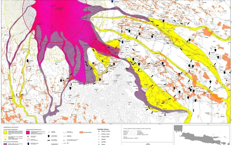
The summit has two parts: the Mahameru plateau, the highest point, and the active Jonggring Saloko crater, a horseshoe open to the south-east, separated by a small valley. The crater has migrated from north-west to south-east over the centuries. At its bottom a lava dome slowly grows, collapses, then rebuilds. This cycle explains Semeru's two faces: small, regular Vulcanian explosions, almost reassuring, and rare catastrophic collapses that send pyroclastic flows down the south-eastern valleys.
The eruptions of Semeru
The Smithsonian Global Volcanism Program records 66 eruptions of Semeru since the first one observed in 1818. It is one of Indonesia's three most active volcanoes, along with Merapi and Krakatau.
19th century. Dutch reports describe moderate explosions almost every year, often with ashfall on Lumajang and Malang.
1909 and 1911. Large explosions and lahars devastate the southern flank. The 1911 eruption reaches VEI 3.
1941–1942. Unusually, a lava flow emerges from the east-south-east flank, between 1,400 and 1,775 m elevation.
Since 1967. Semeru enters the phase that continues today: regular explosions every fifteen to thirty minutes, throwing ash and blocks a few hundred metres above the crater. A dome grows between 1967 and 1977 until it spills over the crater rims, then collapses into pyroclastic flows. In 1977 one of them travels more than 10 km.
1981. Torrential rain remobilises the ash: lahars kill about 250 people and destroy sixteen villages.
1994. On 3 February pyroclastic flows run 11.5 km down the Kembar and Kobokan valleys. Six dead; the volcano's seismic station is destroyed.
2002–2003. On 29 December 2003, a pyroclastic flow travels more than 9 km down the Besuk Bang valley.
4 December 2021. After violent rain, part of the dome collapses. Pyroclastic flows and lahars pour down the Besuk Kobokan valley, bury villages and sweep away the Gladak Perak bridge on the Malang–Lumajang road. The death toll exceeds fifty. It is Semeru's worst eruption in decades.
December 2022. New pyroclastic flows in the same valley, over more than 7 km: the level goes to IV (Awas).
19 November 2025. Major eruption, pyroclastic flows over several kilometres, level IV. Hikers at the lake are evacuated without casualties.
2026. Explosive activity continues at level III, with pyroclastic flows up to 5 km to the south-east in early November.
The full chronology, as recorded by the Smithsonian:
Full timeline: 66 recorded eruptions
| Start | End | VEI | Location |
|---|---|---|---|
| 2019-02-24 | 2026-03-25 | 4 | Jonggring Seloko |
| 2017-06-06 | 2018-10-31 | 4 | Jonggring Seloko |
| 2014-04-01 | 2017-01-09 | 4 | Jonggring Seloko |
| 2013-10-18 | 2013-10-18 | 1 | Jonggring Seloko |
| 2011-05-13 | 2012-07-20 | 2 | Jonggring Seloko |
| 2010-01-05 | 2010-11-29 | 2 | Jonggring Seloko |
| 1967-08-31 | 2009-03-15 | 3 | Jonggring Seloko |
| 1950-07-23 | 1964-12-16 | 2 | Jonggring Seloko |
| 1946-10-29 | 1947-06-16 | 2 | Jonggring Seloko |
| 1946-02-16 | 1946-05-16 | 2 | Jonggring Seloko |
| 1945-06-12 | 1945-06-18 | 2 | Jonggring Seloko |
| 1941-09-21 | 1942-02-16 | 2 | ESE flank (1400-1775 m) |
| 1915-07-02 | ? | 2 | |
| 1913-06-23 | 1913-06-26 | 2 | Jonggring Seloko |
| 1912-08-28 | ? | 2 | |
| 1911-11-08 | 1911-12-16 | 3 | |
| 1910-11-16 | 1911-02-16 | 2 | |
| 1909-09-16 | 1910-03-22 | 2 | |
| 1908-01-16 | 1908-12-16 | 2 | |
| 1907-07-09 | ? | 2 | |
| 1907-01-07 | 1907-01-10 | 2 | |
| 1905-08-04 | ? | 2 | |
| 1904-01-02 | 1904-01-16 | 2 | |
| 1903-03-26 | 1903-06-16 | 2 | |
| 1901-01-29 | 1901-01-30 | 2 | |
| 1900-03-29 | 1900-04-11 | 2 | |
| 1899-12-16 | ? | 2 | |
| 1899-08-11 | ? | 2 | |
| 1899-01-17 | 1899-03-31 | 2 | |
| 1898-02-23 | ? | 2 | |
| 1897-01-01 | 1897-01-03 | 2 | |
| 1896-05-16 | 1896-06-16 | 2 | |
| 1895-05-22 | 1895-10-01 | 2 | |
| 1893-12-11 | 1894-02-16 | 2 | |
| 1893-01-16 | 1893-05-16 | 2 | |
| 1892-03-16 | 1892-04-16 | 2 | |
| 1889-01-16 | 1891-05-31 | 2 | |
| 1888-02-16 | 1888-10-16 | 2 | |
| 1887-08-16 | 1887-10-11 | 2 | |
| 1887-02-16 | 1887-03-16 | 2 | |
| 1886-01-25 | 1886-08-26 | 2 | |
| 1884-12-10 | 1885-09-16 | 2 | |
| 1879-07-02 | ? | 2 | |
| 1878-07-02 | ? | 2 | |
| 1877-09-16 | ? | 2 | |
| 1877-04-16 | ? | 2 | |
| 1872-10-23 | 1872-10-23 | 2 | |
| 1867-04-15 | 1867-05-16 | 2 | |
| 1866-07-02 (uncertain) | ? | 2 | |
| 1865-04-15 | ? | 2 | |
| 1860-04-16 | 1860-06-16 | 2 | |
| 1857-08-13 | 1857-09-16 | 2 | |
| 1856-09-10 | ? | 2 | |
| 1851-01-16 | ? | 2 | |
| 1849-07-02 (uncertain) | ? | – | |
| 1848-08-04 | ? | 2 | |
| 1848-02-16 | ? | 2 | |
| 1845-01-16 | 1845-07-16 | 2 | |
| 1844-09-25 | 1844-09-27 | 2 | |
| 1842-01-16 | 1842-03-16 | 2 | |
| 1838-07-16 | 1838-10-18 | 2 | |
| 1836-08-03 | 1836-08-05 | 2 | |
| 1832-04-18 | ? | 2 | |
| 1830-12-15 | 1830-12-16 | 2 | |
| 1829-02-16 | ? | 2 | |
| 1818-11-08 | ? | 2 |
Source: Smithsonian Institution, Global Volcanism Program. VEI = Volcanic Explosivity Index, from 0 (effusive) to 8 (supervolcano); each step means ten times more material.
How Semeru is monitored
The PVMBG monitors Semeru continuously from the Gunung Sawur observatory at Candipuro (Lumajang), on the south-east flank. Seismographs, cameras and deformation measurements feed a report published every six hours on MAGMA Indonesia (magma.esdm.go.id), the official portal. The report of 16 November 2026 counted 23 explosion earthquakes, one avalanche earthquake and five gas-emission earthquakes in six hours. This is the report we read before every departure.
The Tengger and Semeru
The Tengger live in the highlands of the massif, from Ranupani to Ngadas and as far as Bromo. They are the descendants of Hindu communities who stayed in the mountains when Java converted to Islam in the 15th century. For them, Semeru is the home of the ancestors and the gods, and Ranu Kumbolo a place of purification. The small statues and altars near Arcopodo bear witness to this worship. Respecting these places also means leaving no rubbish there and not bathing.
Around Semeru
- Bromo, an hour away by jeep across the sea of sand: see our guide.
- Ranu Regulo, Ranupani's twin lake, with a quiet campsite, ideal the night before setting off.
- B29, a viewpoint on the rim of the Tengger caldera, from where you see Bromo and Semeru together at sunrise.
- Tumpak Sewu, one of the most beautiful waterfalls in Indonesia, at the southern foot of Semeru.
- Ngadas, the Tengger village with its hanging fields, on the road to Ranupani.
Frequently asked questions
Can you climb to the summit of Semeru in 2026?
No. Since the November 2025 eruption the summit has been off limits and the volcano remains at level III. At the April 2026 reopening, the trail only went as far as Ranu Kumbolo lake. It has been closed since the fire of 27 August 2026. Today's status is in the box on this page, with its source and date.
How many days does the Semeru climb take?
Two days minimum: a day's walk to Kalimati or Ranu Kumbolo, a night in a tent, the summit (when open) during the night and the descent the next day. Three days allow better acclimatisation and time to enjoy the lake. Add a night beforehand in Tumpang or Gubugklakah.
Is climbing Semeru difficult?
As far as Ranu Kumbolo it is a hike any fit person can do. To Kalimati you need to be used to walking six hours with ascent. The final climb to the summit is one of the hardest in Indonesia: 800 m of ascent in sand, at night, in the cold, between 2,900 and 3,676 m.
How much does climbing Semeru cost?
The entrance fee for a foreign visitor is 220,000 IDR (≈ 11 €) per day per person. Our two-day trek, all-inclusive except entrance fees, starts at 2,300,000 IDR (≈ 115 €) per person, depending on group size.
Do you need a guide to climb Semeru?
You can book on your own, but a guide is strongly recommended for a foreigner: changing rules in Indonesian, the risk of getting lost on the descent, reading the volcano and the weather. Porters make the experience much more pleasant.
How do you book the Semeru permit?
On the park's official website, bromotenggersemeru.id, between 30 and 2 days before departure, with a passport per person. You then need a recent medical certificate and must attend the briefing in Ranupani. When you go with us, we do all of this for you.
What is the best time for Semeru?
May to October, in the dry season. April–May for the green, flowering savannah, July–August for the clearest skies but freezing nights. The trail is generally closed from January to March.
Is it cold on Semeru?
Yes. It is around 0 °C at night at Kalimati and at the summit, sometimes lower at Ranu Kumbolo in July–August, when the grass freezes. The wind at the summit makes it feel colder. Bring winter clothing.
Is Semeru dangerous?
It is when people ignore the rules. Deaths on Semeru are due to gas and ejected material near the crater, to getting lost on the descent and, for residents of the south-east flank, to pyroclastic flows and lahars. The normal trail, on the north-west, is not in the path of the pyroclastic flows. Respecting the limits set by the PVMBG and the park reduces the risk to that of a high-mountain trek.
Can you combine Semeru and Bromo?
Yes, it is the natural combination: a jeep links Ranupani to Cemoro Lawang in an hour across the Tengger caldera. See our Semeru – Bromo tour, or the grand traverse Semeru – Bromo – Kawah Ijen.
Is there water along the way?
At Ranu Kumbolo lake (to be filtered or boiled), then at the Sumbermani spring, 30 minutes from Kalimati. There is nothing beyond: go up to the summit with two litres per person.
Can you see Semeru without climbing it?
Yes, and it is a very good idea when it is closed. You can see Semeru smoking from the Penanjakan viewpoint at Bromo, from B29, from the Ngadas road and from the ridges of Arjuno. At dawn, its plume above the sea of clouds is one of the finest views in Java.
Sources
- MAGMA Indonesia (PVMBG), Semeru activity reports, November 2026
- Smithsonian Institution, Global Volcanism Program, Semeru (263300)
- Balai Besar Taman Nasional Bromo Tengger Semeru
- Indonesian press: Metro TV (reopening on 24 April 2026) and fees, Detik (procedure and fees), RRI (closure on 27 August 2026), Antara (hikers affected by the closure), Ministry of Forestry announcement (Katadata, 31 August 2026)
- Our own climbs since 2017
Article updated on 16 November 2026