Why Merbabu
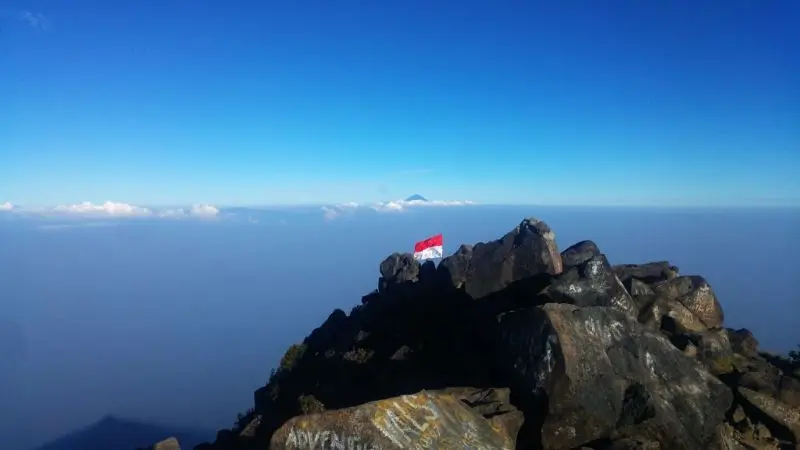
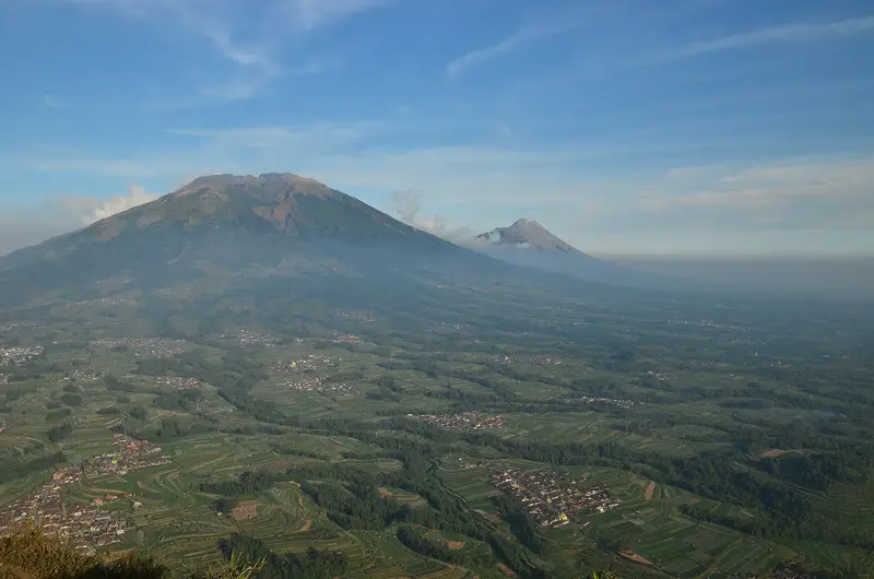
Merbabu is the volcano you climb to look at another one. From its summit at sunrise, Merapi stands right opposite, about ten kilometres away, its steaming dome set above the sea of clouds. Behind it you can see Lawu, Sindoro, Sumbing and Slamet. It is one of the finest volcanic views in Asia.
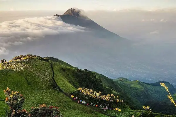
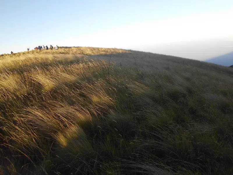
But Merbabu is worth it for itself too. Its slopes were laid bare by old fires and are covered in rolling high savannahs, green in the rainy season, golden in the dry season, which make hikers feel they are walking in the Scottish hills under the tropics. And unlike Merapi, it is calm: its last eruption dates from 1797.
It is the ideal climb for anyone discovering the volcanoes of Java: two days, a camp in the savannah, a summit above 3,000 m, no technical difficulty.
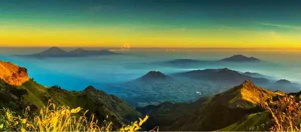
Merbabu at a glance
| Elevation | 3,145 m (Triangulasi summit); 3,142 m at Kenteng Songo |
|---|---|
| Type | Stratovolcano, considered dormant |
| Last eruption | 1797 |
| Management | Mount Merbabu National Park (Balai TNGMb), created in 2004 |
| Routes | Selo, Suwanting, Wekas, Thekelan, Cuntel, Gancik |
| Time | 2 days / 1 night (a long day there and back is possible) |
| Difficulty | Moderate; steep in places |
| Monitoring | Not monitored by the PVMBG |
Is Merbabu open?
The box next to this article gives today's status. Merbabu reopened on 9 March 2026 after the rainy-season closure. At the end of August 2026 it was one of the four parks the Ministry of Forestry left open under reinforced surveillance during the fire season. Online booking is still compulsory, with daily quotas.
Booking and rules
- Online booking is compulsory on the park website (tngunungmerbabu.org), with a quota per route per day.
- Entrance fee for foreigners set by the 2024 national tariff; the amount is not clearly published online: ask for it when you book.
- Rubbish is counted on the way in and out.
- Fires are forbidden: the fires of 2015, 2019 and 2023 burned thousands of hectares.
When to go
- April to October, in the dry season, for clear sunrises over Merapi.
- April–May for green savannahs; August–September for golden savannahs (and the fire risk).
- The park usually closes for part of the rainy season, between January and March.
Nights at camp are cold, around 5 °C, sometimes close to zero in July–August.
Getting there
Merbabu lies between Yogyakarta, Magelang, Salatiga, Boyolali and Semarang. The Yogyakarta and Semarang airports are 1 h 30 to 2 h 30 from the trailheads, and Solo about 1 h 30 from Selo.
The routes
Selo, the Merapi route
The village of Selo (Boyolali), on the saddle between Merbabu and Merapi, is the most popular starting point. The route crosses a pine forest and then successive savannahs (Sabana 1 and 2), where you camp facing Merapi. The summit is 2 h 30 to 3 h from camp. It is the most spectacular route, but also the busiest at weekends.
Suwanting, the savannah route
From Suwanting (Magelang), a steeper route crosses fields and then a series of savannahs. It is known for its scenery and its quiet.
Wekas, the short route
From Wekas (Magelang), to the north-west, the shortest route, steep, with springs along the way. Handy for a quick there-and-back.
Thekelan and Cuntel, the northern routes
The Thekelan and Cuntel routes (Semarang) are the oldest. They cross several secondary summits (Pemancar, Geger Sapi, Syarif) before the main summit. The Cuntel route reopened in 2026 after years of closure.
The summits
Merbabu has several summits. Kenteng Songo (3,142 m) owes its name to the "nine mortars", bowl-shaped hollowed stones considered sacred. Triangulasi (3,145 m), very close by, is the highest point. Both can be reached from Selo or Suwanting.
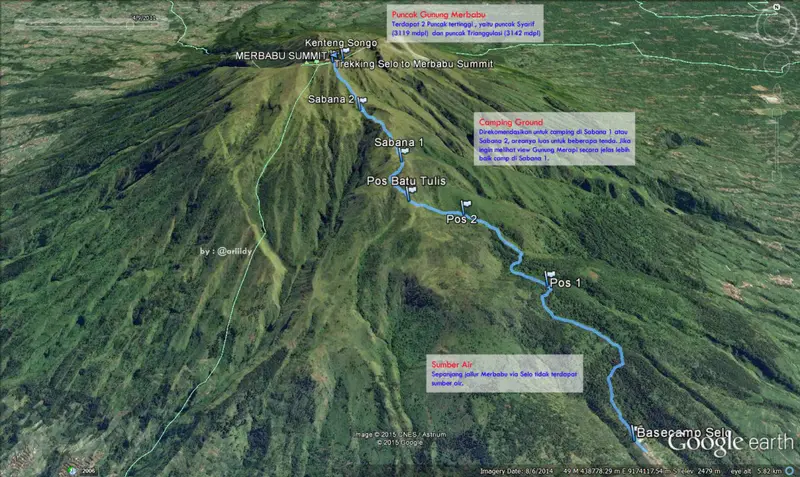
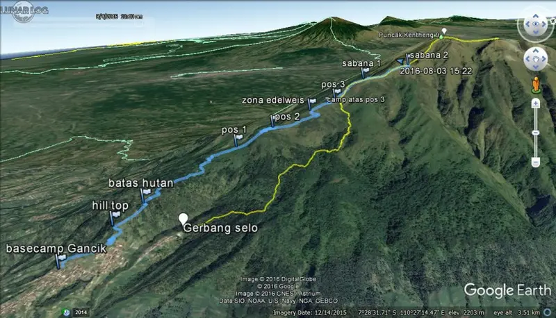
Map and GPX track
- Selo → Sabana 1 et 2 → Kenteng SongoDistance 5 km · Elevation gain 1,252 m · Start 1,849 m → High point 3,123 mDownload the GPX track ↓
- Suwanting → Kenteng SongoDistance 4.2 km · Elevation gain 1,272 m · Start 1,801 m → High point 3,113 mDownload the GPX track ↓
Indicative route from OpenStreetMap; elevations from Copernicus. Check on the ground and follow your guide. © OpenStreetMap, OpenTopoMap (CC-BY-SA), Open-Meteo.
How much does the climb cost?
The entrance fee, paid when you book online, is the only compulsory cost. A guide is not required on the main routes, but is very useful on the northern routes and at night. Porters can be found in Selo or Wekas.
We do not run Merbabu trips. For a similar climb in East Java, with a night in the savannah and a summit above 3,000 m, see Welirang.
The history of the climb
The name Merbabu is said to come from meru (mountain) and abu (ash): "the mountain of ash". The Javanese of the area see its summits as places of meditation: the stones of Kenteng Songo are said to be the work of legendary ancestors. Colonial-era naturalists climbed it to observe Merapi. In the 20th century it became one of the "seven summits of Java" prized by mountain clubs. The national park was created in 2004.
The volcano
Merbabu is a large forested volcano north of Merapi. Three radiating valleys run from the summit to the north-west, north-north-east and east-south-east. Its last magmatic eruptions occurred along a north-north-west to south-south-east fissure crossing the summit, which fed the large Kopeng lava flows to the north and Kajor to the south. Its lava is a basalt, more fluid than Merapi's andesite.
The eruptions of Merbabu
The Smithsonian records only three eruptions: in 1560, a possible one in 1570, and in 1797 (VEI 2), all from the summit crater. Merbabu is not monitored by the PVMBG, for lack of recent activity.
Full timeline: 3 recorded eruptions
| Start | End | VEI | Location |
|---|---|---|---|
| 1797 | ? | 2 | |
| 1570 (uncertain) | ? | – | |
| 1560 | ? | – |
Source: Smithsonian Institution, Global Volcanism Program. VEI = Volcanic Explosivity Index, from 0 (effusive) to 8 (supervolcano); each step means ten times more material.
Around Merbabu
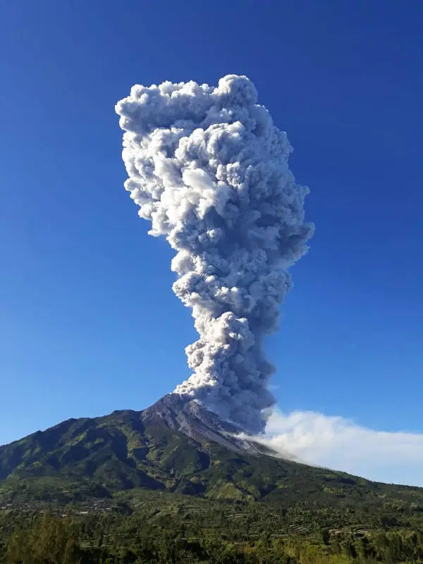
- Merapi, just to the south: see our guide.
- Ketep Pass, the viewpoint between the two volcanoes.
- Borobudur, an hour from Magelang.
- Kopeng, a small hill resort to the north, with its gardens.
Frequently asked questions
Which route should I choose for Merbabu?
Selo for the view of Merapi, Suwanting for the savannahs and quiet, Wekas for a quick there-and-back.
Can Merbabu be climbed in a day?
Yes, from Selo or Wekas, starting very early: 5 to 6 hours up, 3 to 4 hours down. But you miss the sunrise over Merapi.
Do I need a guide?
Not for the main routes by day. Yes for the northern routes and at night, or if you do not speak Indonesian for the booking.
Is Merbabu dangerous?
It is a dormant volcano. The hazards are the cold, getting lost in fog on the ridges and fires at the end of the dry season.
Sources
- Smithsonian Institution, Global Volcanism Program, Merbabu (263240)
- Balai Taman Nasional Gunung Merbabu; RMOL (reopening of 9 March 2026); Kompas (quotas, 2025); Detik (Cuntel route); Ministry of Forestry (Katadata, 31 August 2026)
- Our former Merbabu guide (2019, in French)
Article updated on 16 November 2026